| Your leaking thatched hut during the restoration of a pre-Enlightenment state. |
Hello, my name is Judas Gutenberg and this is my blaag (pronounced as you would the vomit noise "hyroop-bleuach").
![]()
links
decay & ruin
Biosphere II
Chernobyl
dead malls
Detroit
Irving housing
got that wrong
Paleofuture.com
appropriate tech
Arduino μcontrollers
Backwoods Home
Fractal antenna
fun social media stuff
Like asecular.com
(nobody does!)
Like my brownhouse:
Tuesday, March 15 2005
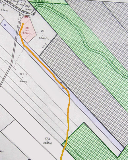
This is from a photo I took of the tax map at the offices of Win Morrison Realty on Sunday. Our parcel is in pink, Catskill State Park land is in green, the parcel that is for sale is in blue, and the Stick Trail is in orange. You can see the "access road" with dubious right of way running along the west side of our property. (On this map, north is at the top and one inch is about 850 feet on most monitors.)
For linking purposes this article's URL is:
http://asecular.com/blog.php?050315
previous | next